Good Reading
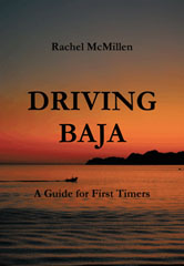
 Driving Baja: A Guide for First Timers
By Rachel McMillen
Trafford Publishing, 2009
Available from Trafford Books: Paperback
Driving Baja: A Guide for First Timers tries to answer questions that first-time Snowbirds who are thinking about driving (perhaps with RVs) down the Baja are likely to ask: “…could we really do it? Is it safe to drive there? Are the roads OK? What if the car breaks down? How do we buy food? Can we take the dog? What if we get sick? Can we drink the water?”
Baja California is a peninsula, over 1,000 miles long. There is a chain of mountains running down the center. Highway 1 zigzags its way down from Tijuana on the northern border to Cabo San Lucas on the southern tip, passing through most of the major cities and towns of the Baja. There are other major highways as well, but Driving Baha “is only intended to help you drive down Highway 1 safely and comfortably so you feel free to do your own exploring.”
Geographically, Baja California is “still a region of small villages and tiny farms,” but most of the population lives in the north, near the U.S. border, in Tijuana and Mexicali, and in the resort town of Ensenada, 70 miles south. The only other city of size is La Paz, 854 miles to the south, “a quiet lovely place with a very Mexican ambience,” and which even has a beach north of the city where at no cost — for months at a time — Snowbirds park their RVs.
Two hours south of La Paz is the resort complex of Cabo San Lucas and San Jose del Cabo, complete with Costco, Walmart, and Home Depot.
In “Before You Go,” McMillen offers important advice. For example, “You MUST have Mexican auto insurance,” which you can purchase over the internet. You should set up internet banking and switch all regular bills to electronic billing, which you can then pay on-line using inexpensive internet cafes all over Baja. Be sure to tell your bank and credit card companies the dates you will be in Mexico or your cards may be declined when you need them the most. Put together a good first-aid kit that includes things like Pepto-Bismol and Imodium. Carry a surge protector for your computer.
The next chapter, “Roads,” explains what it is really like to drive in the Baja (not so bad, actually) and suggests some simple precautions… never drive at night, and always keep your eyes open for wandering cattle, horses, burros, and goats.
“Roads” is appropriately followed by “Road Signs” and, although her Spanish-to-English list contains some unfortunate Spanish typos, it is nevertheless useful. Curvas Peligrosas, for example, means “Dangerous Curves,” and Cruce de Peatones means “Pedestrian Crossing.”
This chapter is followed by “Crossing the Border,” how to pick up your tourist card, how to prepare for easy inspections, and what to do at military checkpoints.
Eventually you will be hungry, and so the chapter “Food” tells you what foods are easily available, what you should stock up on in advance… “Good bread is probably the one basic item that is hardest to find.”
Again, her English-to-Spanish (with pronunciation guide) list of common foods contains too many Spanish typos, but it is still useful. We discover that eggs are huevos, butter is mantequilla, strawberries are fresas and garlic is ajo.
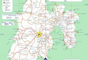
The final chapter, “Distances, Itineraries & Campsites,” lists RV parks throughout The Baja. A not very detailed map appears on the back cover.
Driving Baja can be useful supplemental reading for those contemplating “driving Baja,” but other guides are much more thorough. I prefer Traveler’s Guide to Camping Mexico’s Baja by Mike and Terry Church, complete with detailed maps.

